Kerguelen/Heard Island Simulations
This page describes a suite of numerical simulations of gravity waves over
Kerguelen and Heard Islands as observed by six different overpasses of the AWE
instrument.
Computational Domain
The mesh in the horizontal direction is shown in the figure below.
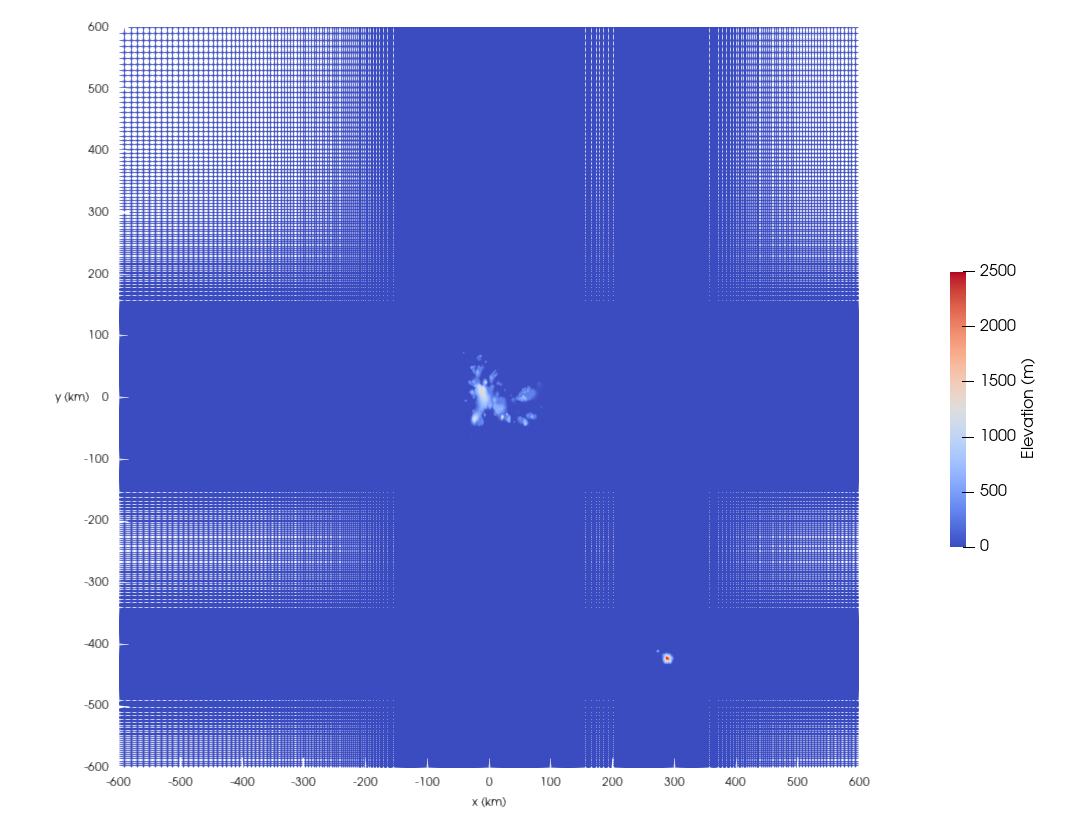
The mesh is clustered near both Kerguelen and Heard islands and then is gently stretched with increasing distance to the horizontal boundaries. The spacing in both x and y is 500 m near Kerguelen Island and is 800 m near Heard Island. The vertical grid spacing is 500 m from the surface to an altitude of 102 km, where it is then gently stretched to the upper boundary at 112 km. A sponge layer occupies the stretched region between 102 and 112 km. The (x,y) origin corresponds to (49.3° S, 69.2° E). Inviscid wall boundary conditions are used at the lower surface whereas characteristic (radiative) conditions are used in combination with a sponge layer at the lateral and top boundaries.